|
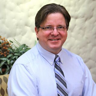
Mark Schnesk is a Senior Applications Engineer for Seiler Design Solutions and has over 30 years experience as a civil engineering and survey technician in the infrastructure design and geospatial industry.
He has worked for firms in Michigan, Florida and Illinois in various capacities on infrastructure and survey projects including transportation, utility and land development. A native of Flint, Michigan and a graduate of Michigan Technological University, he now resides in Union, Missouri with his family. Mark is an AutoCAD Civil 3D Certified Professional, an Autodesk Certified Instructor and also an FAA Part 107 licensed drone pilot. |
|
Jason Taylor is a 3D scanning expert and geospatial sales professional for Seiler Instrument, and is based in the Kansas City Office. Previously, Jason worked for a regional engineering firm in their surveying, geospatial, and remote sensing division. He has over 20 years of surveying experience, including nearly 15 years of experience with a variety of laser scanning applications. Jason has completed a wide range of 3D laser scanning projects including geotechnical hazard analysis, dam deformation studies, and dozens of bridge & highway surveys. Jason is the Business Development Director, & Sales Professional responsible for our MX9 & MX50 Mobile Mapping Systems, TIMMs cart mobile mapping system, Trimble Static Scanning Solutions, and also for our GeoSLAM product line. He works closely with clients in many industries, helping them use 3D laser scanning to increase productivity.
|
Land Mobile & UAV Field to Finish Solutions
Presented by Mark Schnesk and Jason Taylor
Thursday, January 12, 2023
1:00 - 5:00 p.m.
An examination of current UAV platforms & payload options.
An overview of mobile mapping options & workflow.
Data processing & feature extraction workflows demonstrated in various software packages.
(Autodesk, TopoDOT, TBC)
An overview of mobile mapping options & workflow.
Data processing & feature extraction workflows demonstrated in various software packages.
(Autodesk, TopoDOT, TBC)


