|
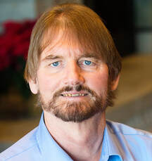
Michael Frecks is the Survey/LiDAR manager for TREKKS’s Omaha area office with direct responsibility for nationwide mobile LiDAR services. Michael has 43 years of land surveying experience with extensive knowledge and hands on experience with LiDAR applications since 2000. He has worked with DOTs, owners and AEC firms on more than 300 successful projects using various mobile LiDAR systems. His extensive surveying experience supporting civil transportation includes: GPS (static, post-process kinematic chains and real time kinematic); total stations (field to finish and back to field, robotic total stations); static scanning (phase based and time of flight); mobile (line scanners and 3D-field–of-view systems). This foundation provides the spatial recognition needed for mobile LiDAR acquisition and QA/QC. Over the course of his career, he has performed beta testing on survey software and hardware for Leica Geosystems because of his knowledge of project workflows and interactions.
|
Expanding Platteview Road Starts with Expanding the Tools
Saturday, January 8, 2022, 8:00 - 9:50 a.m.
Surveying for transportation can be hazardous and often driven by an aggressive schedule. Surveyors have the tools to not only compress the schedule but make the experience safer. This presentation will explore how the data acquired from traditional boots on the ground survey, mobile LiDAR, UAV photogrammetry and UAV LiDAR was combined to acquire base mapping on a projected $200 million project in Sarpy County, Nebraska.
Surveying for transportation can be hazardous and often driven by an aggressive schedule. Surveyors have the tools to not only compress the schedule but make the experience safer. This presentation will explore how the data acquired from traditional boots on the ground survey, mobile LiDAR, UAV photogrammetry and UAV LiDAR was combined to acquire base mapping on a projected $200 million project in Sarpy County, Nebraska.


