|
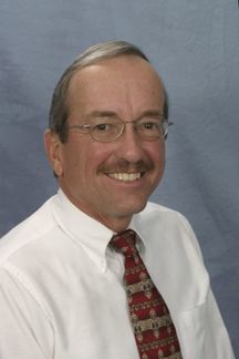
Steve is a graduate of Kansas State University with a BS in Civil Engineering. He has been a licensed Professional Engineer in Kansas since 1976. Steve was a design engineer and project engineer for Wilson & Company, Engineers & Architects, Salina, Kansas. During his tenure as a Professor at KSU-Salina, Steve taught Algebra, Trig, Computer Science, Surveying, Civil Engineering, GNSS, and GIS technologies. He has also taught GNSS/GIS at Cloud County and Butler County Community colleges. Steve has been a member of the KS GIS Technical Advisory Committee since 1988. In 1990 Steve established the first GNSS Base Station for the State of Kansas at KSU-Salina. That same year with a grant from the NSF. he established the first GIS/GNSS Associate Degree option in the nation at KSU-Salina. Steve has served as a grant reviewer for the NSF, helping them determine which GNSS/GIS proposals to fund nationally. Steve has also been a Civil Engineering/GNSS/GIS consultant working with the Kansas Rural Water Association, and others on GNSS/GIS issues related to surveying, mapping and e911.
|
Surveying, GNSS, and GIS in Nigeria
Saturday, January 12, 2019, 8:00 - 10:00 a.m.
In February of 2017 Joe Paiva and I traveled to Lagos, Nigeria, to teach classes on Surveying, GNSS, and GIS. My presentation is about that trip, our trials and travails getting to and from Lagos, what we taught, and what we learned. The surveyors in Nigeria are going through a major transformation in their industry much like the 2022 changes that we are facing here in the U.S. In my presentation I will compare our systems and anticipated changes to those the surveyors in Nigeria are facing. Nigeria is currently attempting to build a network of Continuously Operating GNSS Reference Stations similar to our CORS network. They are also beginning to shift from a traditional datum (in ground monumentation) tailored to their region, to a datum aligned with the current International definition, much like our upcoming change in horizontal from North American Datum 1983 (NAD83) to North American Terrestrial Reference Frame 2022 (NATRF2022) and change in vertical from North American Vertical Datum 1988 (NAVD88) to North American-Pacific Geopotential Datum of 2022 (NAPGD2022). We have traditionally used Kansas State Plane Coordinates (NAD83) in US feet where they have used Universal Transverse Mercator Coordinates (UTM) in meters. How will these changes affect us?


